Brownie Lake, Minneapolis, MN
Discovery of the Hidden Gem of the Minneapolis Chain of Lakes
At the far north end of the infamous Minneapolis Chain of Lakes, lies a hidden treasure! Relatively unknown to most, well-loved by locals – and almost impossible to get to – is a tiny lake named Brownie Lake.
Continuing in our 2021 Travel Dates to explore the world-class city of Minneapolis, we visited its beautiful Chain of Lakes. Our day ended with a journey to discover a lake I knew only by name and sight, but nothing more.
Our visit to Brownie Lake proved to be quite an adventure!
My History with Brownie Lake
Having lived in the area some years ago, I had always considered Brownie Lake just a “puddle pond” next to the highway (south of I-394, between Penn Avenue and Hwy 100).
I only recently discovered that it was not only an official “lake” – but part of the Minneapolis Chain of Lakes and Parks. It is enjoyed for its fishing, canoeing/kayaking, swimming, biking and walking. It was a fun discovery!
Join with me as I share the story of this adventure – and our discoveries – with you!
P.C. Cher B. 22 August 2021
Brownie Lake: Our Story
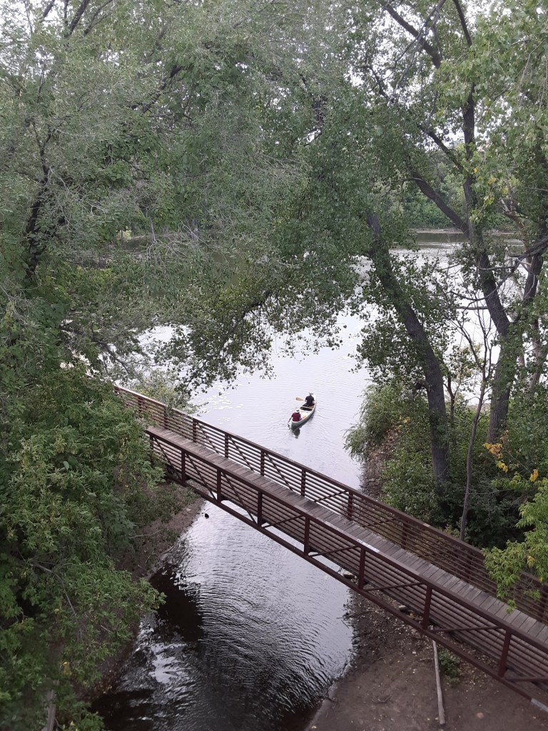
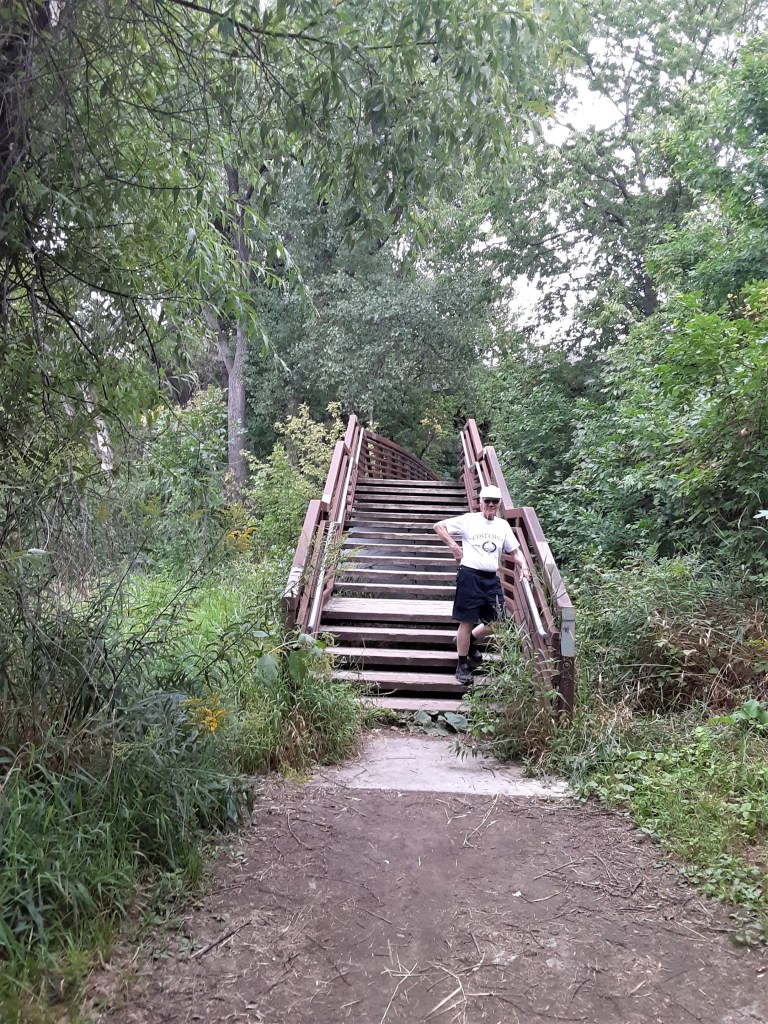
We stood on the upper bridge – looking longingly on the idyllic scene below us. The well-crafted walk bridge assured us that people on foot, as well as in canoes and kayaks, were welcome. But we looked and looked – and still had no idea how to get there.
After driving across the upper street bridge several times, looking for a designated place to park to enter the Brownie Lake Park area, we gave up and parked on a residential side street.
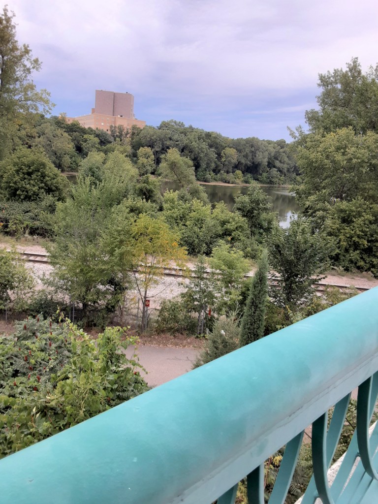
From the bridge, we could see the lake to our north and west.
Try as we may, we could see no easy – or even marked – route to get to the lake.
We kept searching… for even a hole in the wall! Or a hole in the fence?!

P.C. Cher B. 22 August 2021
Crossing the Rail Road Tracks
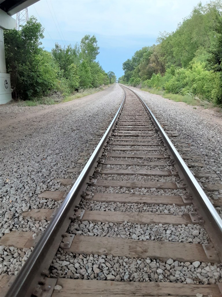
From the south side of the bridge, we discovered a set of stairs leading to the path below. But between that path and the lake were ominous rail road tracks.
I knew a bit about the “obstacle” of the railroad tracks from my study of Cedar Lake. They are a major barrier for access to the north side of that lake. Now it was proving to be a major barrier to us for access to Brownie Lake.
P.C. Cher B 22 August 2021
The railroad was fenced off for safety; understood. But it was a force to be reckoned with to get to the lake from the south and southeast.
P.C. Cher B. 22 August 2021
In fact, once we finally got to the lake, we could hear the train rumbling on the tracks just behind the trees next to the path!
The Bridge
After much exploration, and nearly giving up, we discovered a worn, but certainly not “sanctioned” path, alongside of the street bridge going down a steep rough incline to the railroad tracks.
P.C. Cher B. 22 August 2021
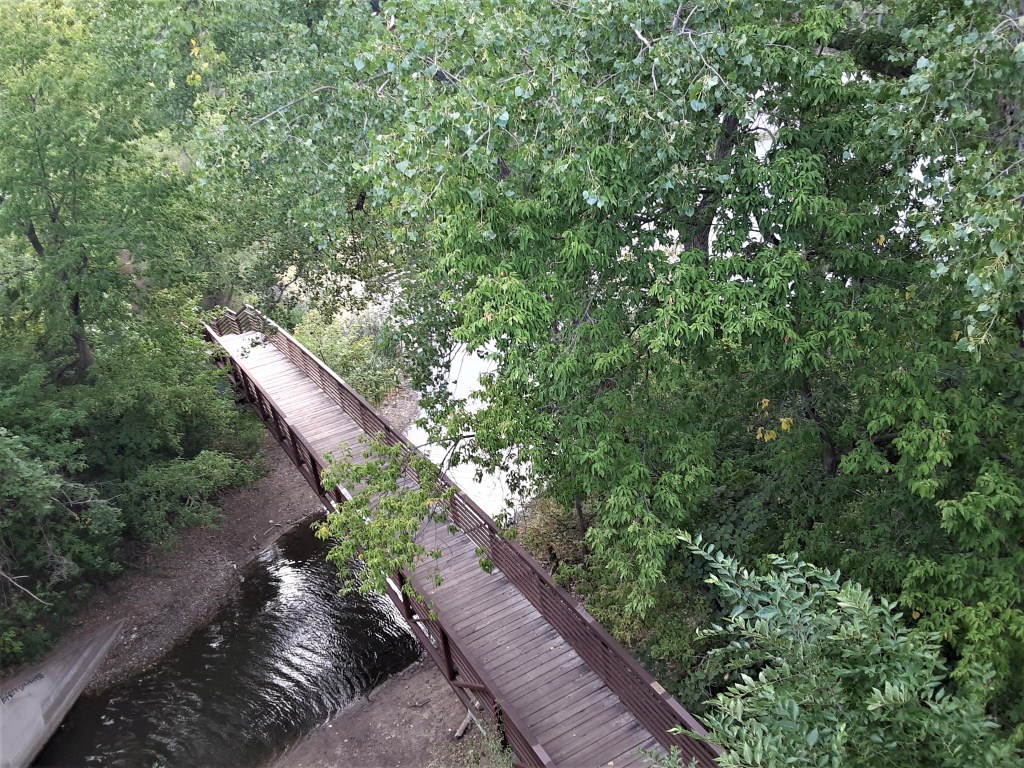
Down we went! At the bottom, we came out on the north side of the railroad tracks, found – and crawled through – an opening in the wire fence, and ended up by the coveted foot bridge below!
P.C. Cher B 22 August 2021

P.C. Skip B 22 August 2021
The wooden footbridge connected us to the dirt path around Brownie Lake. We could see the spot where canoes and kayaks moved through a tunnel-like channel between Cedar and Brownie Lakes and traveled under this bridge.
We knew our path to the lake was not “official” or “sanctioned” and continued to wonder where those might be!
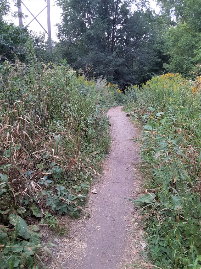
The Dirt Paths
What we discovered was a much different landscape and path than the paved paths around the other lakes in the Chain. Brownie Lake is encircled by a packed dirt walking trail. This adds to the rustic, rural nature of the area.
We soon discovered that these paths connect cohesively with several other trails around the other lakes and neighborhoods. We had fun discovering new and connecting paths!
. . But we still had no idea as to the origin of those paths!
Mountain Biking Trails
Within Brownie Lake Park, a 1.4 mile single track mountain biking trail, the first “Black Diamond” trail in Minneapolis, built in 1916, connects to major loops.

P.C. Cher B 22 August 2021
P.C. Cher B 22 August 2021
Along one of these paths, we met a friendly mountain biker who provided additional insight on where one of the paths began (or ended) to the south of us – and alerted us to an impending rain storm in 45 minutes! (We had noticed the sky darkening!)
Bends in the road…
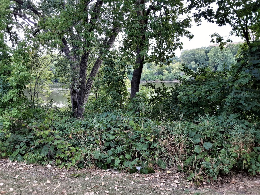
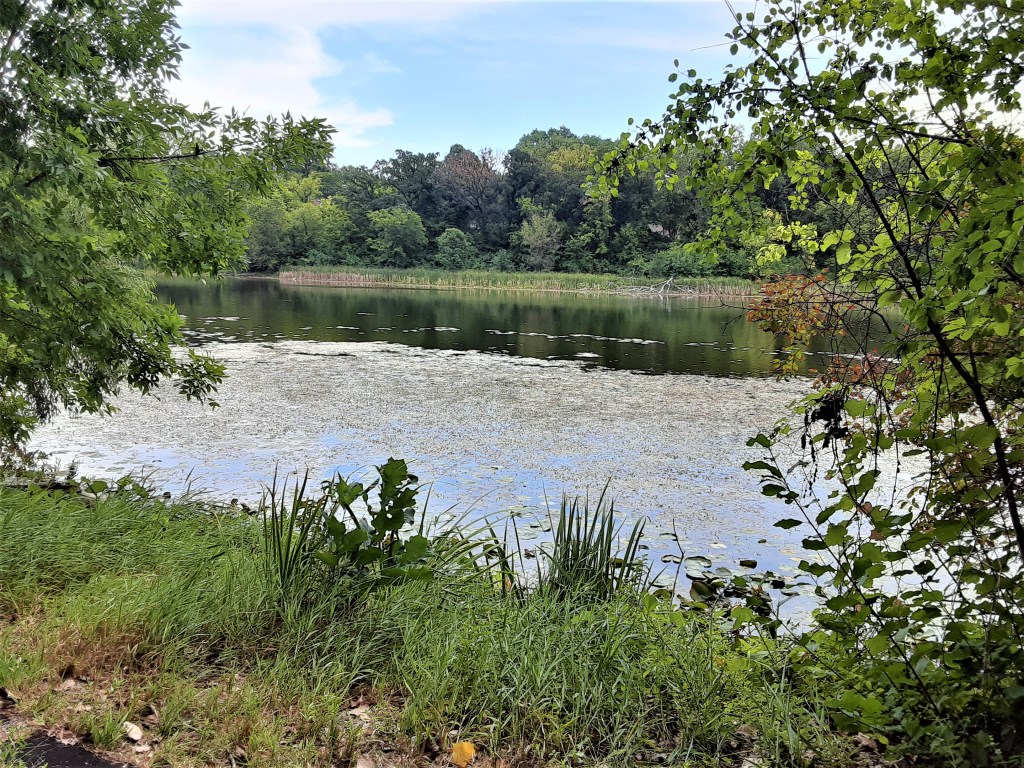
As we walked around the lake, each opening in the trees revealed a new and lovely picture of this quaint little lake.

P.C. Cher B 22 August 2021
Originally, we only planned to “check it out.” We had not planned to walk around the whole lake! But each bend in the path opened new vistas – and enticed us to keep going until we were back where we started!
P.C. Cher B. 22 August 2021
Lily Pads and Water Lilies
The lake itself was mesmerizing. The lily pads and water lilies added to the ambiance and character of Brownie Lake.
P.C. Cher B. 22 August 2021
P.C. Cher B. 22 August 2021
Discovery: An interesting bit of trivia I learned: Brownie Lake is a meromictic lake...
In case you didn’t know… (like us!) … this means there are two layers of water in the lake with different physical and chemical conditions, and which do not intermix in spring and fall as occurs in most lakes in the northern temperate zone. (Interested in learning more? Check out info on this interesting phenomenon on the park’s website)
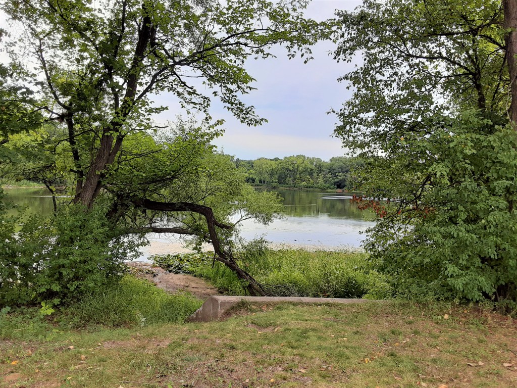
Brownie Lake Beach
Markedly different than any other beach in the Chain was the primitive sandy beach and boat launch in the northwest corner of the lake.

P.C. Cher B. 22 August 2021
A kayak silently glided across the lake.
Here we met a friendly barefoot fisherman and his dog, who filled us in intriguing pieces of the lore of the lake. It was his favorite lake because of its remoteness right in the middle of the city!

P.C. Cher B. 22 August 2021
Crossing the Rail Road Tracks. . . Again
We completed our trek around the lake. We crossed the railroad tracks – again. This time, we climbed through a different hole in the fence and climbed a new “unofficial” dirt path back up the hill to the street. As we got in our car, the rain drops began to fall on our windshield. Our 15 minute quick stop to “check out Brownie Lake” ended up 90 minutes later.

P.C. Cher B. 22 August 2021
We never did figure out the sanctioned paths to get to Brownie Lake. The park website was no help. Our friendly human encounters assured us that it was possible. But I am unable to provide any Travel Tips on those details. It was a satisfying and fun adventure; one we will always remember! Someday… I’ll figure it out…and you’ll be the first to know! (Insider tips from those in-the-know are welcome!)
Important Data on Brownie Lake
In my intrigue with sharing our story about our experience at Brownie Lake, I’ve neglected some vital details important to its identity. Here they are!
How did Brownie Lake get its name?
As I’ve discovered, the name of a lake is significant. This one is no different. “Brownie” was the nickname of Agnes McNair, daughter of William McNair, owner of the land on which the lake sat. It predates the 1883 creation of the park board. In 1908, the lake was acquired as a part of the Glenwood (Wirth) Park. 1913 plans indicated that it was labeled “Hillside Harbor.” However, there is no record that the park board ever officially changed the name – so “Brownie Lake” it remains!
How does Brownie Lake fit in the Minneapolis Chain of Lakes?
Brownie Lake is the northernmost lake in – and the baby of – the Minneapolis Chain of Lakes.
As a visual person, I believe that maps and pictures are critical to appreciating anything. Here are ones that helped me visualize this lake.

from twincitiesoutdoor.com/paddle-mpls-chain/ 21 August 2021
Brownie Lake connects to Cedar Lake first, and then Lake of the Isles and finally, Bde Maka Ska, as seen in the red lines in the Canoe/Kayak map.

In the photo above, looking south, Brownie Lake can be seen above/foreground, with Cedar Lake in the back/left. The walk bridge is in the upper left of the lake; the beach at the lower right.
The square map of the canoe/kayak route gives both perspective on the size and placement of Brownie Lake in the Chain of Lakes as well as the water route between the lakes.

The map (lists Bryn Mawr at top) lays out a bit of the area of Brownie and Cedar lakes. The dark green shows the wooded areas. The slice across the top (“C,” “A” and “N”) is helpful to visualize the swath the railroad takes through the parks. (I do not have a key to the lettering so just ignore them!)
Motor boats are not permitted on Brownie Lake. A canoe/kayak rack is located near the dirt boat ramp at the northwest end of the lake. Rack spaces can be rented from the Minneapolis Park and Recreation Board.
Conclusion
Like my post on Raspberry Island, St. Paul, MN, I have again discovered that sometimes the smallest of small can become the biggest adventure of all and holds the most delightful results!
I’m also keenly reminded that when I think there may not be much to discover or learn, I can easily be surprised! Such is the case with the delight in the discovery of this tiny lake that, for decades, I had thought didn’t merit investigation.
Thank you, Brownie Lake! You now hold a fond place in my heart and memory file! (And I’ll keep investigating how to get to your shores in a more appropriate and sanctioned manner!)
Sources
- Self-Guided Tour by Cher and Skip B. 22 August 2021
- Photos by Cher B and Skip B unless otherwise noted
- Minneapolis Parks: minneapolisparks.org
