Nicollet Island on the Mississippi, Minneapolis, MN USA Part of the Heritage Trail
I was excited to explore Nicollet Island on our Travel Date to the banks of the Mississippi River as it flows by downtown Minneapolis.
I knew enough about the island to realize 1) I really knew very little and 2) I wanted to know a whole lot more!
And the more I learned about this little island, the more its story became real to me… I share it with you.
- Coming soon: a more comprehensive blog on our Minneapolis Travel Date exploring the Mississippi Heritage Trail beyond Nicollet Island.
Once upon a time. . . there was a tiny little island named Nicollet. . .
Living in a city known for its parks, Nicollet Island is perhaps the most unusual of parks.
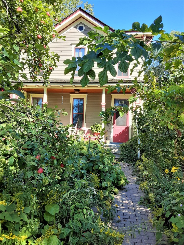
This little island is a 48 acre sliver of land in the Mississippi River beside downtown Minneapolis. It is home to a secluded enclave of historic homes which literally sit ON TOP OF public park land.
An often-overlooked landmark of early Minneapolis – Nicollet has gone through several radical transformations in his documented life.
Nicollet Island looks – and feels – dramatically different today than it did half a century ago when I lived as a University student in Minneapolis in the late 1960’s.
Join me as we explore the intriguing story of Nicollet – this fascinating little island – together!
Private residence on Nicollet Island. P.C. Cher B 9/22/21
Where is Nicollet Island?
How did it get its Name?
Where is the island?
Nicollet Island is an island on the Mississippi River in Minneapolis, Minnesota, USA – just north of St. Anthony Falls. . .
The island makes up a part of the city-designated Nicollet Island/East Bank neighborhood.
How did it get its name?
The island’s namesake is that of the gifted cartographer, Joseph Nicollet, who mapped the Upper Mississippi in the 1830s. (I could not find any reference to its name prior to this)
P.C. Cher B 9/22/21
Who was Joseph Nicollet?
Joseph N. Nicollet (1786-1843), a French astronomer, arrived in Minnesota in 1836. He led three expeditions exploring the Upper Mississippi, mostly in the area that is now Minnesota, North Dakota and South Dakota. Much of what we know of the area can be credited to him. He is said to have been “a scientist with the sensitivities of an artist.”
Besides Nicollet Island, his name is applied to several places in the region he explored, including Nicollet Avenue (Minneapolis), Nicollet County and the city of Nicollet, all in Minnesota.
Nicollet Island: the Last Island Standing

P.C. Cher B. 9/18/21
In the early 19th century, Nicollet Island was not alone. It was one of six islands near the falls. Sadly, all the others have been destroyed or joined to the east bank, leaving Nicollet as the only true island today.
As time wore on, the northward movement of the falls continued its push its way up the Mississippi. In the late 19th century, in the attempt to protect the falls, the ecology, and its impact on the community, this movement had been stopped, but not until several islands had disappeared or been absorbed into the shoreline.
Nicollet somehow remained steadfast. However, had this intervention not occurred, Nicollet island would also no longer exist.
Given its history – and close proximity to St. Anthony Falls – makes the island a rare entity. This alone is significant to appreciating the island.
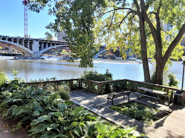
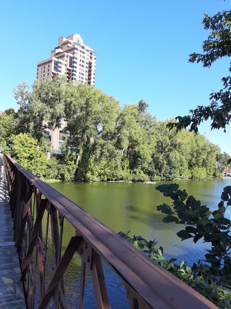
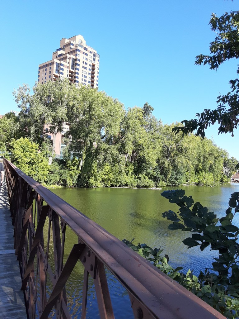
These photos look taken on Nicollet Island look to the east bank (north) toward St. Anthony Main. Looking to the west bank (south) is downtown Minneapolis and the St. Anthony Falls.
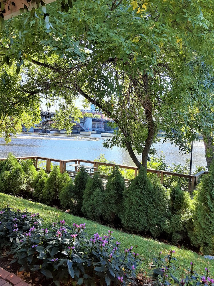
P.C. Cher B 9/18/21
Nicollet Island: The People who called It Their Home

P.C. Cher B 9/18/21
First inhabitants: Ojibwa and Dakota
Steeped in history and spirituality, the first inhabitants of Nicollet Island were the Native American Ojibwa and Dakota. The island was considered a sacred nexus to the spiritual world. It was known as a birthing place for the Dakota and a site for their vision quest ceremonies.
White Settlers: 1838
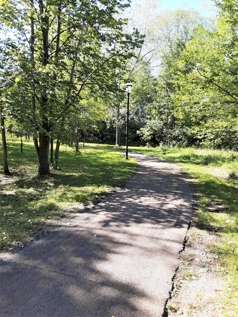
When it was first opened to white settlement in 1838, the island was covered with sugar maple and elm trees. The north side of the island was the residential district as it still is today.
A visitor can still feel the ground underneath one’s feet, and hear the wind whispering in the trees as one uses the walk paths around the island. Some are dirt; some are paved.
While most of the island is a park, the primary public wooded area of the island near the pavilion. It surrounds an amphitheater on the south end that was constructed in 1976 to celebrate the country’s bicentennial.
P.C. Cher B 9/18/21
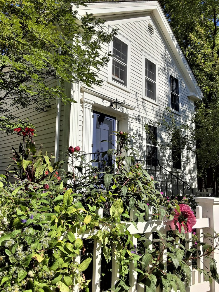
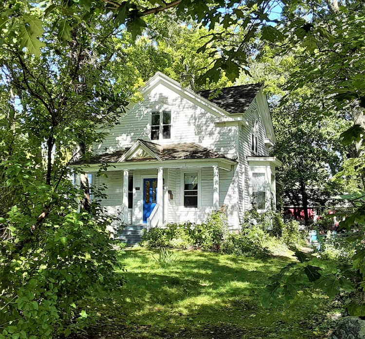
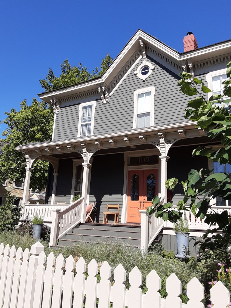
The Houses of Nicollet’s Island
Nicollet’s Life is Drastically Changed. . .
One of the most interesting facts about Nicollet, the island, is that while the houses on Nicollet Island are privately owned, none of them own the land on which their houses sit! Most of the land on the island is owned by the Minneapolis Park Board.

P.C. Cher B 9/18/21
In the late 1970s, Nicollet experienced yet another land owner. The Minneapolis Park and Recreation Board bought most of Nicollet Island, including the land beneath just over 20 historic homes. Long term land leases ensured the homes were restored and preserved by their owners. Local government agencies had already demolished a dense collection of industrial commercial buildings on the island.
P.C. Cher B. 9/18/21
Because the land is public park land, visitors to the island can freely enjoy viewing these beautiful historical homes! Ample street parking is free.
1865 brought one of the biggest changes in Nicollet’s life. Nicollet was purchased by two businessmen, William W. Eastman and John L. Merriam.
Original plans were to sell the island to the city as a park. The city said “no.” Turning it into a business venture, they began building mills on the south side of the island. Along the way, there were some grave mistakes, including building a tunnel, which collapsed in 1869 and almost destroyed the falls. Oops! (This is a whole separate story–too extensive to include in this tale!)
Nicollet’s life changed again during the late 19th century. During this era, the city’s Gilded Age, the wealthy built their houses on the island. Nicollet’s streets were filled with fashionable people in horses and carriages enjoying lavish parties on the banks of the Mississippi River.
One of the fashionable places was the historic Grove Street Flats, an 8 unit luxury townhouse complex built in the 1870s. It was one of three multi-family residential buildings.

P.C. Cher B 9/18/21
Grove Street Flats is still a fashionable place to live. It was rehabbed in the 1980s into 18 units and is one of the most unique walk up condo complexes in the metro area, with rooftop patios and interior light shafts in some units.
P.C. Cher B. 9/18/21
Today, there are twenty-two restored Victorian-era homes on the north end of the island. Records (2020) show that only six houses have been sold since 1922, and have a high real estate value.

P.C. Cher B. 9/18/21
According to the US Census Bureau, the island has a land area of 0.075 square miles. A 2000 census recorded a population of 144 persons. While this number fluctuates, it remains fairly low.
P.C. Cher B. 9/18/21
What does Nicollet’s Island look like Today?
What will happen to him when the house leases are up?
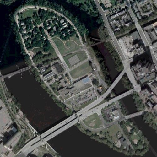
This fairly current map shows the layout of the island, described from top left of photo down to lower right.
- The top section shows the private residential houses with parkland at the very tip.
- Below that one can see the winding walk paths through grass and trees.
- Next is the railway connecting downtown (Left side) and NE Minneapolis (right side).
- Below the RR tracks, on the left, is Grove Street Flats. On right open areas are the football fields of DeLaSalle High School.
- Next is the high school with its parking lot next to the Hennepin Avenue Bridge.
- Just below the bridge, on the right of the island, is Nicollet Island Inn. Roof and parking lot are seen.
- The bridge on the lower right connects the island to St. Anthony Main.
- At the tip of the island, lower right corner, are the Nicollet Island Pavilion and park lands.
What will happen to Nicollet Island when the leases for the houses are up?
There is already a “2080 Plan” in place by one individual for the time when the leases on the homes expire. This would be to move the houses south to allow for denser development on the island’s north end.
Opposition to these plans run high. Protestors argue that people would ruin the ambiance of the island with ambition.
Nicollet Island is seen much like being in a “small town in a city” that has developed organically – and should continue to do so. It is something you polish. You don’t try to fix it.
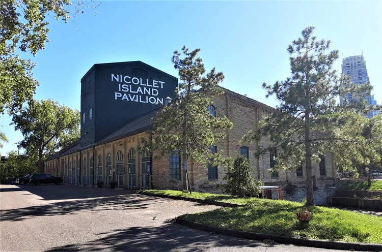
Nicollet Island Pavilion
A Living Remnant of Nicollet’s Past for Today’s Events
P.C. Chdf B. 9/18/21
P.C Cher B 9/18/21
The Nicollet Island Pavilion is on the south end of the island, closest to St. Anthony Falls. It is a popular event center hosting lovely, picturesque weddings on the riverfront.
Built in 1893 as the William Bros Boiler Works, it is one of the only remaining industrial buildings.
P.C. Cher B. 9/18/21
On the map of Nicollet Island below, the Pavilion and park are on the lower right hand side.
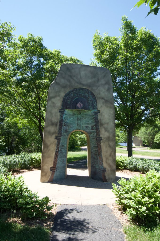
Near the pavilion is the monument, Bell of Two Friends, a gift from the city of Ibaraki, Osaka, Japan.
Nicollet Island Inn
A Living Remnant of Nicollet’s Storied Past for Today’s Hospitality
The Inn took its present form during the 1970s with the reconstruction of south and west walls. Double-hung windows set in a regular pattern throughout the building transformed its outward appearance from a rustic industrial façade to a truly welcoming inn.

Architecturally, the Inn has seen a series of changes and improvements. Its limestone construction, unique to a time period, depended on brick as its primary building material. Cut limestone bricks were laid in a random ashlar pattern, giving the building an appearance that was both casual and solid.

P.C. Cher B 9/18/21
The Inn’s interior, consisting primarily of heavy timber and beam construction, was renovated to create both intimate spaces and beautiful views. The old loading dock was glassed in to create a romantic dining room with gorgeous views of the Mississippi River and its North Bank.
The upstairs bar and lounge provides guests with a casual setting for unparalleled views of Nicollet Island Park. The bar is over 150 years old, has original stained glass and carved maiden heads, came from the drugstore in a small New Hampshire seaport town.
Taking its present form as the Nicollet Island in during the 1970s, it was built in 1893, originally as the Island Sash and Door Company. Between 1913 and into the 1970s, it served a variety of uses including a Salvation Army’s men’s shelter.
The Nicollet Island Inn is now one of the few buildings that remembers the earliest days of development on Nicollet Island. Tall and proud, it stood witness to over a century of change on the Mississippi River’s storied shores. Some were subtle and some dramatic; some were gentle and some turbulent.
Today’s Nicollet Island Inn evokes the charm and ambiance of a bygone era while showering its guests with surprisingly modern conveniences. Every detail—from antique appointments and stained-glass windows to hand-carved woodwork and a glass-enclosed elevator (with the original operator’s seat)—harkens back to a time when street cars roamed the by-ways of a town still in its infancy.
In the map above, the Nicollet Island Inn is in the lower right of the photo. It is in the square block on the right side of the island, in the corner just below the Hennepin Avenue Bridge. The bridge to its right going to St. Anthony Main, can be also seen to the photos on the right.
In the Inn’s basement, what once served as a coal bin is now a beautiful patio dining area terraced outside the Island Banquet Room.
P.C. Cher B. 9/18/21

P.C. Cher B 9/18/21
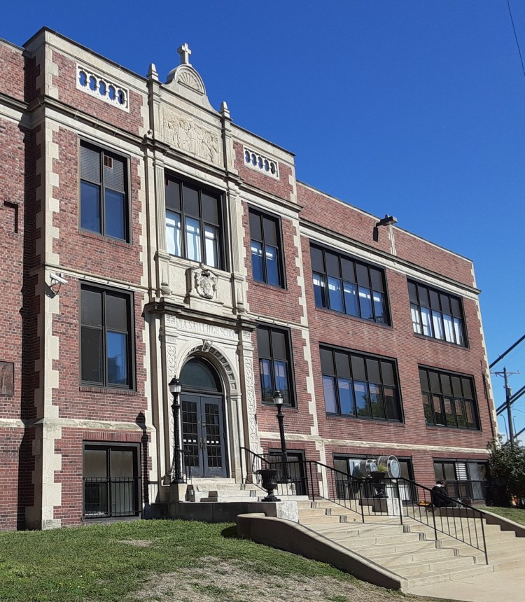
Nicollet’s High School
DeLaSalle: the High School on Nicollet’s Island
Nicollet has also proudly provided rigorous academic services for over 100 years!
The DeLaSalle coach at the time (2009) commented to MPR News: “It’s just amazing — [the team] had to jump on a bus every Friday night and go — have their homecomings at Brooklyn Center, MN, Roosevelt. It is shocking, and you don’t hear about it. Fortunately you won’t have to hear about it anymore at DeLaSalle.”
https://www.mprnews.org/story/2009/09/03/delasalle-football-first-home-game
DeLaSalle High School
In 1900, Lasallian Brothers, an order of Roman Catholic priests, started DeLaSalle High School on the island. Built partially on its own private land and partially on city park land, it has faced some unique challenges during its 100+ year tenure!
This Roman Catholic preparatory high school has produced winning football teams for years and years – and without a home field! Until 2009, it never hosted its own home game – and then not without controversy!!

P.C. Cher B. 9/18/21.
Controversy surfaced with major objection by the neighbors on the island when the high school tried to build a football field. It only went ahead after a ruling by the Minnesota Court of Appeals in 2007. The new field sits partially on land that’s still public — owned by the city’s Parks board.
DeLaSalle High School complex is near the center of this photo, just above the Hennepin Avenue Bridge. Starting just above the bridge is the school parking lot, then the high school, and the football field above that and on the right.
Nicollet’s “Lighter” Side of Life!
Iconic Neon Grain Belt Beer sign
On a lighter side, (pun intended!) but still just as critical to its story, is Nicollet’s iconic neon Grain Belt Beer sign!


P.C. Cher B. 9/18/21
The Eastman family (same family who originally purchased the island in 1865) owns both the sign and the land, and have continually paid the property taxes and kept the sign out of nostalgia. The protection provided by its local heritage designation has also benefited the sign.
Nicollet Island is part of the Saint Anthony Falls Historic District, and any modification to buildings and structures within the district require City and/or Heritage Preservation Commission (HPC) approval.
Arguably the most beloved, most mysterious, and most written about sign in Minneapolis, the Grain Belt Beer sign on Nicollet Island, has a rich, colorful history.
Built in 1941 for $5,000, the Grain Belt Beer bottle cap sign is one of the largest freestanding neon signs in the Midwest. The sign is approximately 50 feet wide and 40 feet tall.
The Hennepin Avenue Bridge cuts across the lower portion of the above photo. DeLaSalle High School is on the island just above the bridge in the near center of the photo. Look closely for the towers at the end of the bridge nearest to the school. The Grain Belt Beer sign is in the trees (tiny vertical dash) just between the street and the river.

P.C. Cher B. 9/18/21
You can get an up close and personal view of the sign by walking on the west side of the Hennepin Avenue Bridge. To get a head-on view of the sign, walk down the staircase on the downtown side of the river or view it from West River Road. It is reported that the view from the boat docked next to the sign is likely another great vantage point, but we didn’t try that!.
Visiting Nicollet Island
Getting on and off Nicollet Island: by foot, by car, by rail
Visiting Nicollet Island is easy and there are multiple ways to get onto the island – but you have to know where they are!
Once on the island, there is ample parking on the street or in the various lots. While it is park land, remember that the houses are owned and lived in by private individuals – so please be courteous and respectful. If you are attending an event at the pavilion or the high school, dining or lodging at the inn, check out parking specifically for those sites and events.
Are you coming into Minneapolis on the train?
This route is NOT for cars or pedestrians! But if you are coming in by rail, you might get a view of the island out your window. (Don’t blink! You might miss it!)

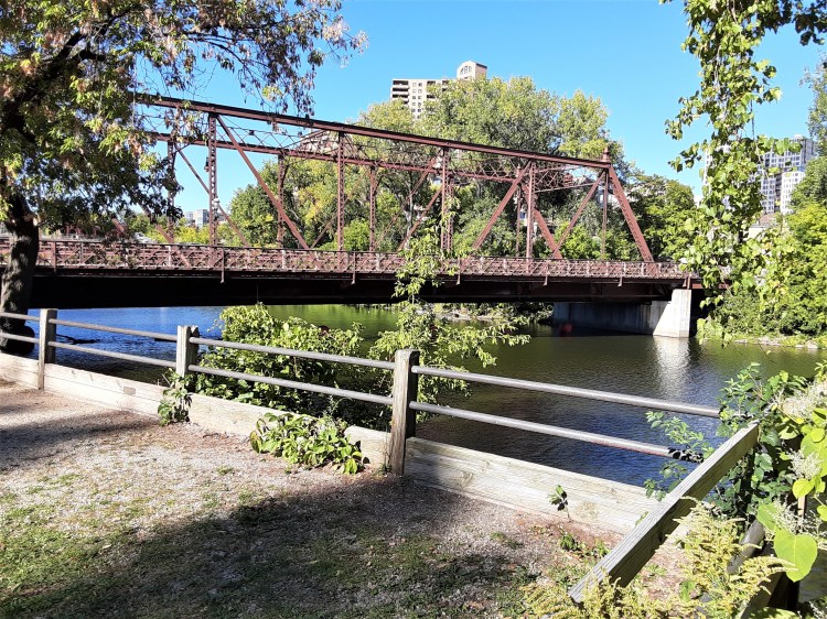
In 1867 the first railway bridge across the Mississippi in Minneapolis was built, separating the industrial south of the island with the residential north. Today, the Minneapolis BNSF Rail Bridge (1893 replacement) still does.
Today, the railroad goes between downtown and Northeast Minneapolis, crossing Nicollet Island between the houses on the north and the high school in the middle.
Are you coming from downtown Minneapolis?
Are you following the Heritage Trail?
Then you want to take a walk across the Hennepin Avenue Bridge, iconic in its own rights. (Be sure to check out the huge Grain Belt Beer sign; see separate section above)

P.C. Cher B 9/18/21
In 1855, the first bridge across the Mississippi opened on the site of the present Hennepin Avenue Bridge. A part of St. Anthony Falls Historic District, it is listed on the National Register of Historic Places.
Today, this bridge connects downtown with Northeast Minneapolis, with exits to Nicollet Island on the way.
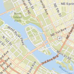
These maps may help you better visualize the island and its access points.
- Top (map on right) is Boom Island Park and bridge to north end of Nicollet Island. (see photos on far right column)
- Middle (light line) are the railroad tracks cutting through the top 1/3 of the island. (see photos on far left column)
- Double bridge in the lower 1/3 of the island is the Hennepin Avenue Bridge (#47) connecting downtown (on the left) and NE Minneapolis (on the right).
- Bridge going from the lower 1/3 of the island to Main Street SE is the one by the Nicollet Island Inn.
Are you coming from St. Anthony Main or NE Minneapolis?
Walk (or drive) on the car and pedestrian bridge connecting Nicollet Island and St. Anthony Main. It will put you at the Nicollet Island Inn (to your right) or the Pavilion) to your left.
Take a turn to the right side of the Inn to get to DeLaSalle High School or the houses at the north end of the island. Plenty of on street parking if you want to explore.
P.C Cher B 9/18/21
P.C Cher B 9/18/21
Are you coming from Boom Island Park?
If you are exploring Boom Island Park, you can use this walk bridge to get onto Nicollet Island.

It will get you to the north end of Nicollet Island where you can follow the path along the river – or climb the stairs and end up by the houses.


Nicollet’s Story: Reflecting on a Sad Era in Its Life
Not all of Nicollet’s storybook island is one of beauty and glamor. As with much of anyone’s life, its story included a very sad, sad time. It was one that resulted in major transformation in its life – and I’m pleased to share – has a happy ending, as seen in the tales above!
Nicollet Island looks radically different today than it did half a century ago in the late 1960s. It is this time when, as a University student, I lived in the city. In fact, at that time, Nicollet’s island was a blight on the city and a place to be avoided at all costs.

From its humble beginnings as a spiritual island for the Dakota and Ojibwa –
. . . to an active participant of the Gilded Age scene of the wealthy folk of Minneapolis in the late 1800s –
. . . to an industrial hub in the early 1900s;
Nicollet’s island had always a place to be revered.
But that all changed. By the 1950’s, Nicollet’s island had become the city’s skid row.
During the 1960’s, the island was packed with industrial buildings, as seen in the photo above. A strip of commercial storefronts occupied the area around where the Hennepin Avenue bridge is today.
The 1960s also brought the Age of the Hippies, who had begun to put down roots on the island. The grand Victorian houses fell into great disrepair.
Drunks – and flophouses which had been displaced by the clean up and demolition of downtown’s “skid row” – claimed their spots on Nicollet Island.
With the 1970s came new problems. Records show that murder victims were sometimes dumped on the Island. “Bread-line” suicides off the Hennepin Bridge were persistent.
Poor Nicollet. . . viewed as an insidious Hell-hole by the public, the island was a place to be shunned.
During the 1970s, the debate over Nicollet Island’s future coincided with a push to buy more parkland for a regional parks system. There were over 10 plans deciding his future.
While it was generally agreed that Nicollet’s island should not be industrial anymore, city planners were intent on leveling most of the buildings. The commercial buildings along Hennepin Avenue were razed, as were many industrial buildings.
Residents put up a fight when the wrecking ball began to topple historic homes. The city backed off after a consultant said the properties – many dating to the 19th century – were a rare collection.
In the end. . . after a fight with the city’s redevelopment authority, the Park Board ultimately acquired much of the island. The city sold the historic homes via a lottery system to owners who could restore them. Several homes were also moved there from elsewhere in the city.
By 1971, the island was part of the St. Anthony Falls historic district, one of the first in the state.
What will happen to Nicollet and his island when the leases are up?
There is already a “2080 Plan” in place by one individual for the time when the leases on the homes expire. This would be to move the houses south to allow for denser development on the island’s north end. As one can imagine, opposition to these plans run high. Protestors argue that people would ruin it with ambition.
So… the story of Nicollet’s island continues…
It has been said that Nicollet Island is like being in a “small town in a city. ” It developed organically. It is something you polish. You don’t try to fix it.
I encourage you to take a few hours and explore this rare gem in our beautiful city!
Sources
- fmr.org/news/2019/06/20/restoring-habitat-urban-island
- DeLaSalle High School football field – mprnews.org/story/2009/09/03/delasalle-football-first-home-game
- Grain Belt Beer sign – historicminneapolissigns.wordpress.com/signs/grain-belt-beer/
- Minneapolis Homes – homesmsp.com/2016/nicollet-island-the-only-inhabited-island-on-the-mississippi.html
- Nicollet Island Inn – nicolletislandinn.com/about/our-story/
- Star Tribune – startribune.com/how-did-nicollet-island-become-parkland-with-private-housing-on-it-curious-minnesota-investigates/508757581/
- ussbb62.blogspot.com/2016/05/

De La Salle High School was founded by the De La Salle Christian Brothers. We do not have any ordained members (priests) other than our founder St. John Baptist de La Salle (1651-1719).
LikeLike
Thanks!
LikeLike