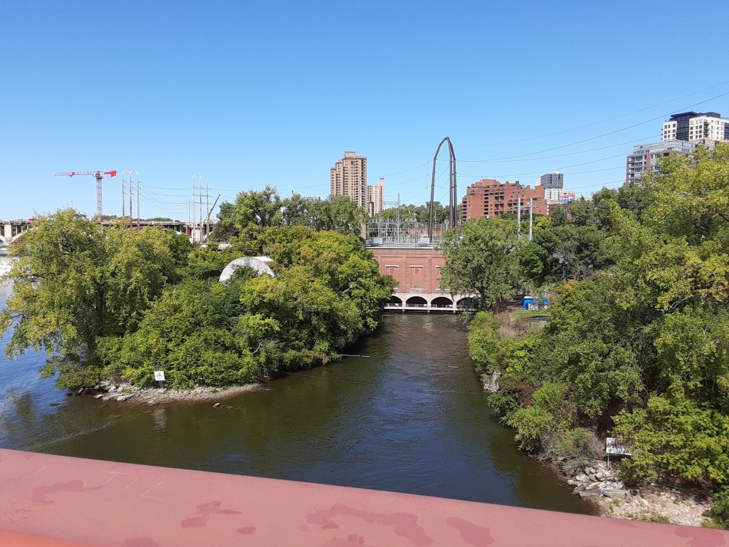
Hennepin Island on the Mississippi River,
Minneapolis, MN USA
I love exploring islands! There is something mysterious about them, as if they are just waiting to be “discovered!” When I was in college, a couple of my friends and I rented a houseboat for the weekend and explored the islands in the St. Croix River which runs between Minnesota and Wisconsin. As an adult, for a donation, I gained ownership of a few shoreline feet of the island owned by my favorite childhood church campground!
This summer, I have been enjoying our Travel Dates as we explored some of the islands near downtown Minneapolis and St. Paul, Minnesota. I have written blogs about a few: Nicollet Island, Raspberry Island and Harriet Island
One thing I discovered was that there are so many islands on the Mississippi River!
I was astonished to learn that there are more than 115 islands dotting the Mississippi River in the greater Twin Cities metropolitan area alone! 115!!! These islands are strung along the river like giant stepping stones of all shapes and sizes on a 46-mile river corridor that flows from the Coon Rapids Dam south to the Cottage Grove area. Wow! Do I want to visit all 115 of them? Maybe . . . !
In our recent Travel Date exploring the area around St. Anthony Falls on the Mississippi River near downtown Minneapolis, we also discovered Hennepin Island. Hennepin is a common name in Minneapolis: Hennepin Avenue, Hennepin Avenue Bridge, Hennepin County, Hennepin… [insert name of business] – but an island too? That lead us to ask many questions. Where is it? What is it? Is it really an “island?” We learned the answers to these questions, and so much more! I hope that this blog will be of interest to you as well.
Hennepin Island, Minneapolis, MN

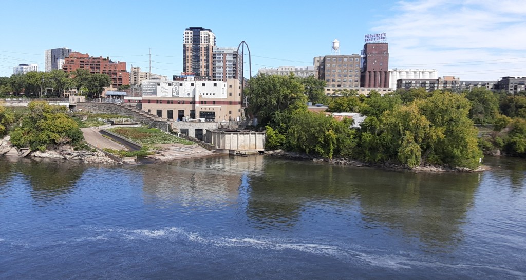
Hennepin Island is on the side of the Mississippi River opposite downtown Minneapolis. It is easily accessible from St. Anthony Main area near the Pillsbury “A” Mill.
Unlike Nicollet Island, just a bit upstream, it is not as clearly defined as an actual “island.”
Hennepin Island is defined by two distinctly different areas: Water Power Park and Fr. Hennepin Bluff Park. Different, yes – but also alike. Both parks allow the visitor to get up close and personally involved with the river!
I look forward to sharing my intriguing discoveries with you in this blog.
View of Hennepin Island and the skyline of St. Anthony Main area from the Stone Arch Bridge. PC Cher B. 9/18/21
Hennepin Island: the Experience
Hennepin Island is no longer an actual island – unlike Nicollet Island, its close neighbor to the north which is surrounded by water on all sides. Over time, Hennepin Island has been absorbed, at least in part, into the shoreline next to it.
PC Cher B. 9/18/21
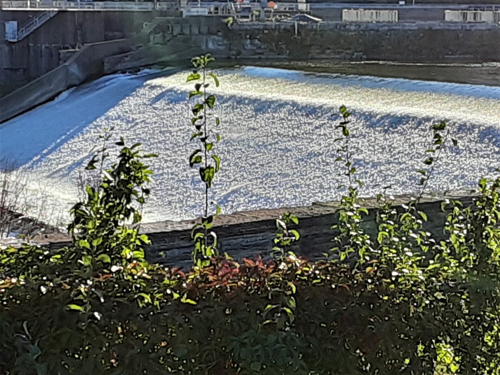
As we ventured onto this tiny piece of land, one thing was very clear: we were experiencing the Power of the Mighty Mississippi River up close and first hand!
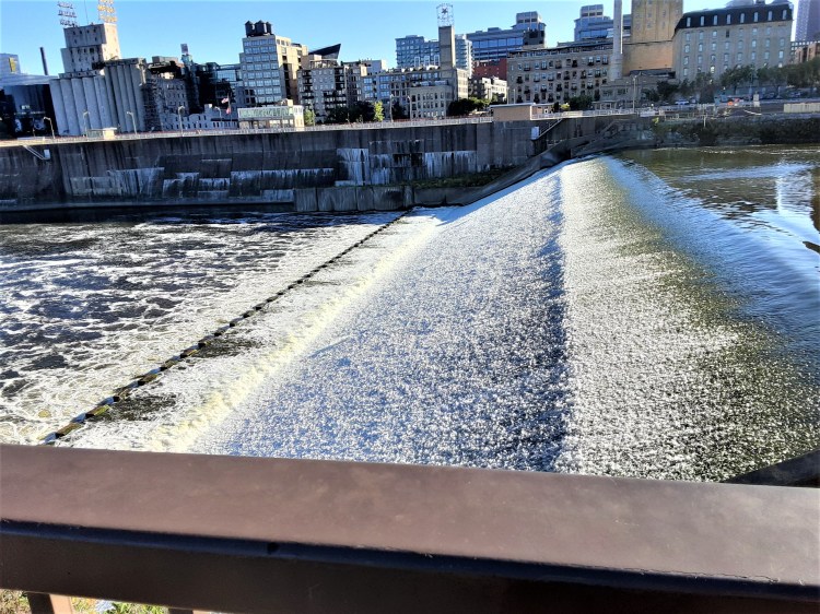
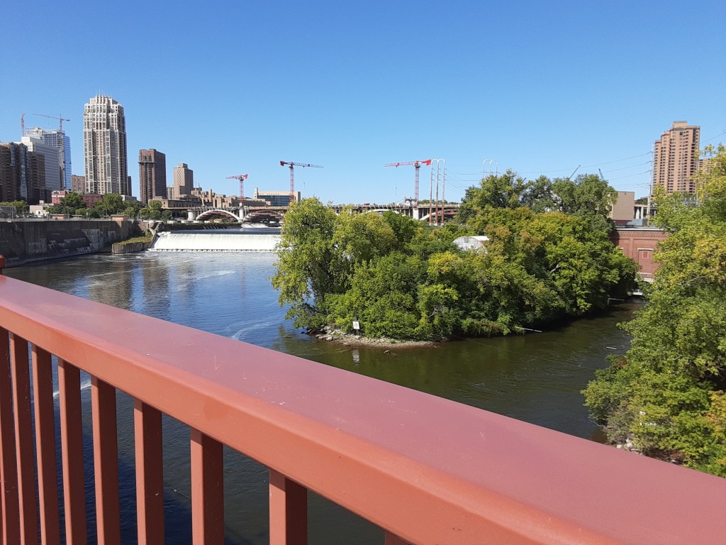
Water Power Park: From our vantage point (see photo on left), we could feel the spray, hear the roar, and sense the energy of this great river as it flows over St. Anthony Falls.
Father Hennepin Bluff Park: Conversely, in this secluded park (see photo on right), we experienced a totally different aspect of the river. We were able to climb down the stairs of the steep wooded bluffs and get face to face – or toe to toe (!) – with the river. This time we could feel it quietly lapping on the shoreline.
PC Cher B. 9/18/21
Hennepin Island: its History
The history of the area is largely about power: Spiritual, Physical and Political power.

- Native Americans regarded the falls as having significant spiritual power.
- Logging interests floated logs south to the falls where entrepreneurs built sawmills that tapped the power of the falling water to cut logs into lumber.
- Industrialists used the falls to power flour mills.
- The power of the falls was harnessed for a commercial hydroelectric power station, dramatically changing the way the community developed.
- Politically, the discussion continues today. Who controls the river resources? Whom will benefit? How will competing claims be accommodated?
View of St. Anthony Falls and Hennepin Island from the Stone Arch Bridge. PC Cher B. 9/18/21
How did Hennepin Island get its Name?
As with all islands, there is a story behind how it got its name.
Long, long ago – nearly 350 years ago in 1680 – a Franciscan priest named Father Louis Hennepin led a French expedition down the Illinois River to its mouth, where they turned north up the Mississippi River. Together with a Dakota party, they headed upriver to what is now St. Paul and then traveled overland to the Dakota villages in central Minnesota on Mille Lacs Lake.
I was intrigued by this destination and side-story since I grew up with Mille Lacs Lake in my back yard! I can attest to the fact that Hennepin’s legacy in Mille Lacs Lake area remains today. A state park named for him is located on the southeast corner of the lake – where there is also another Hennepin Island! If you are boating in the area you can check it out, but it is not something to consider for a day trip looking for a place to have a picnic lunch! Made up of two tiny rock islands, this Hennepin Island measures just over half an acre and is the smallest National Wildlife Refuge in the USA.
That summer (July of 1680), Hennepin moved again, this time traveling south on the Mississippi River. He eventually came upon the falls known to the Dakota as “Owahmenah” (falling water).
Fr. Hennepin named the falls St. Anthony, after his patron Saint Anthony of Padua. Today’s park is at the traditional location of an ancient portage route around the St. Anthony Falls. It is very likely that Hennepin may have first observed the waterfall from the shores of this little park that now bears his name.
Side Note: Hennepin was also the first European to make a record of viewing Niagara Falls.
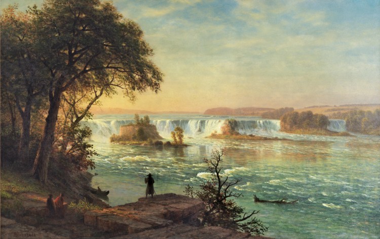
Since there were no cameras to record the event or the site, I am grateful for the artists who did. Thanks to this painting by Albert Bierstadt, we can get a glimpse of what the falls may have looked like in Fr. Hennepin’s time. It is certainly different than the falls we view today!
In the foreground, you will notice that Bierstadt depicts a man with a stick, wearing a hat and seen from behind. Recent research has suggested that this figure could be the Franciscan missionary Louis Hennepin.
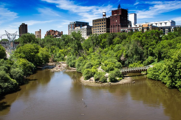
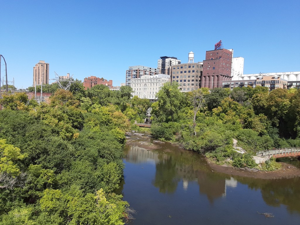
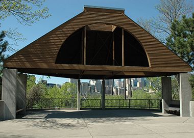
Father Hennepin Bluff Park
Father Hennepin Bluff Park consists of 5.5 acres and sits on a steep, wooded bluff overlooking the Mississippi River. It is adjacent to Pillsbury Park (on street level) and connected to the many parks on both sides of the river through an extensive trail system. Check out the Minneapolis Park System for details.
Fr. Hennepin Bluff Park offers direct access to footpaths and bridges that display a unique view of the Mississippi Gorge, the downtown Minneapolis skyline, and the Stone Arch Bridge.

PC Cher B 9/18/21
PC Cher B. 9/18/21
The area is a mix of several small parks which merge seamless together. A portion of the park is officially known as Phillip W. Pillsbury Park, and another half-acre of land on the bluff, Lucy Wilder Morris Park, (which I never found) was officially added to the park in 1989.
The entrance to the Pillsbury Park is just off of St. Anthony Main through which one can also gain entrance to the Stone Arch Bridge.
Entrance to the bluffs is via a series of wooden stairs and bridges eventually ending up at the river’s edge. It can challenging to find – but the climb down – and of course back up – are well worth the time and effort.
PC Cher B. 9/18/21
minneapolisparks.org/parks__destinations/parks__lakes/father_hennepin_bluff_park/

PC Cher B 9/18/21
Water Power Park
The Water Power Park is not at all like the other parks adjacent to it. Immediately accessible off of the sidewalk on St. Anthony Street, across from St. Anthony Main, one could easily think one was trespassing on private property!
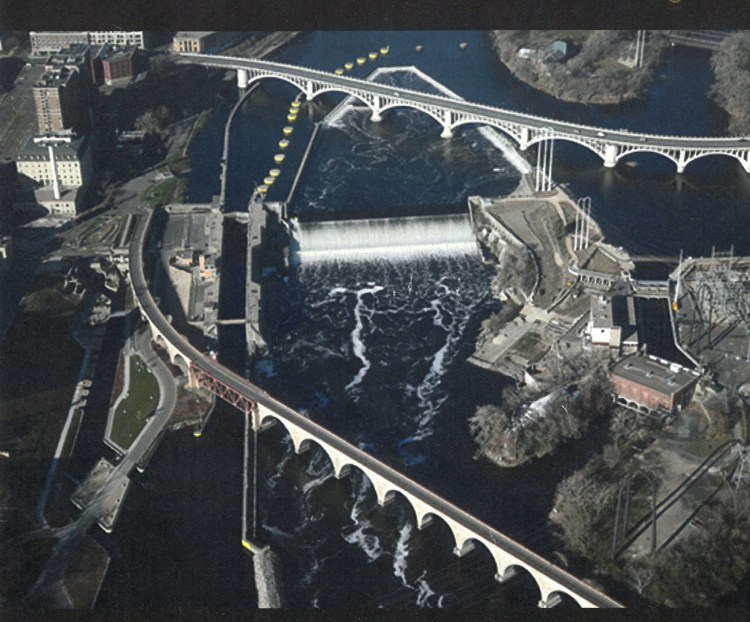
- Hennepin Island is the area on the right side of the photo.
- Father Hennepin Bluff Park is in the lower right corner, closest to the Stone Arch Bridge.
- Water Power Park is the more open area seen just to the right of the falls.
- The tip of Nicollet Island can be seen in the upper right corner.
- Mill City Ruins area is on the left.
Watch for the entrance signs, and enter through an iron gate, cross over a walkway which runs along side of the building and leads to a pedestrian bridge across the spillway separating the plant from Hennepin Island.
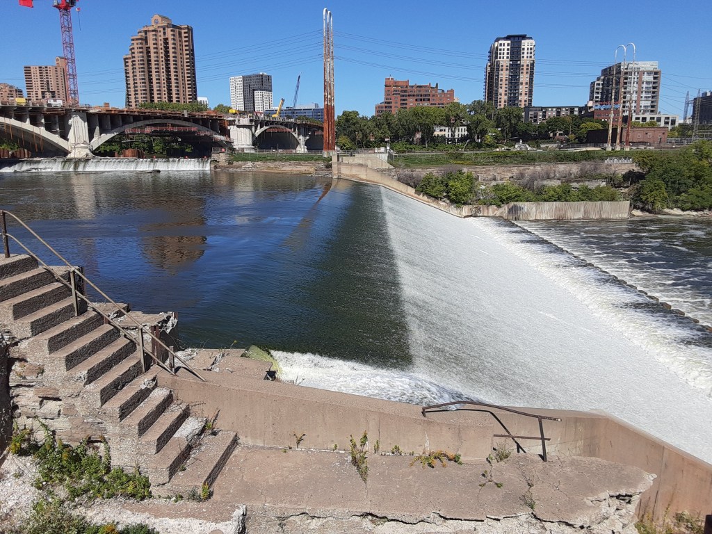
A space opens before you that provides spectacular view of the falls. Its landscape is rocky and barren, putting all one’s focus on the main event – the falls!
In the photo on the left (St. Anthony Falls Lock Walk brochure), this area can clearly be seen on the right side.
The 1.4 acre park is owned by Xcel Energy and was created as a condition of the re-licensing agreement for its St. Anthony power plant. While owned by Xcel Energy, the park is managed by the Minneapolis Park and Recreation Board.
For visitors, the official address is: 204 SE Main St, Minneapolis, MN 55414
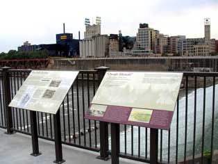
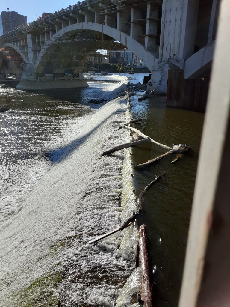
Interpretive panels describe the re-engineering of the falls from a natural cascade into one harnessed for industry.
Water Power Park commemorates the nation’s first commercial hydroelectric generation station and how hydroelectric power changed the nation.
Water Power Park: Views of the River
Water Power Park is the portion of the island nearest to, and overlooking, the falls. It truly provides the closest possible approaches to the falls.
The historically important Hennepin Island Hydroelectric Plant operates here by Northern States Power/Xcel Energy. One condition of their license is the creation of a recreation area to show the evolution of St. Anthony Falls, which was successfully accomplished.
In 2008, NSP/Xcel collaborated with the University of Minnesota’s St. Anthony Falls Laboratory on a new Outdoor Stream Lab which studies the site’s ecology and hydrology. The plant still generates about 12 megawatts and is one of 85 contributing properties of the St. Anthony Falls Historic District which is listed on the National Register of Historic Places.

P.C. Cher B. 9/18/21
P.C. Cher B 9/18/21
P.C. Cher B 9/18/21
P.C. Cher B 9/18/21
PC Cher B 9/18/21
PC Cher B. 9/18/21
Aster Cafe: Culinary Conclusion to a Perfect Travel Date
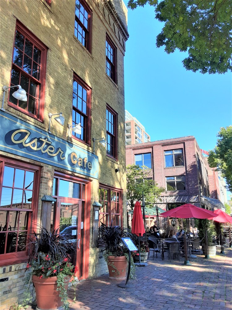
We began the route for our day trip planning ahead – knowing where we wanted it to conclude! This spot!
Across St. Anthony Street from Hennepin Island parks are several eateries in St. Anthony Main. All have picturesque settings with tasty options, depending on your preferences and budget.
For us, the outdoor dining space of the Aster Cafe has been a long time favorite. It did not disappoint!
It was the perfect end to a perfect day!


As we quickly discovered, the area around the Mississippi River near downtown Minneapolis is fascinating! It is filled with interesting sites to visit and explore. There are fun experiences to be had. It is packed with beauty, history, nature and discovery. This blog highlights yet another island of the many islands in the Mighty Mississippi River!
Other blogs of this area for you to enjoy include: Nicollet Island, Stone Arch Bridge, St. Anthony Falls, Guthrie Theater & Neighbors, St. Anthony Main and Mill City Ruins (coming soon!) Check back as additional ones become available!
Visit
Visit Hennepin Island and its parks is easy and can be relatively inexpensive (depending on culinary and parking choices!)
- All parks are accessible off St. Anthony Street in the St. Anthony Main area along the river.
- Admission to all the parks is FREE.
- Parking is plentiful. Ramps (fee) and on-street metered parking is close-by. Free on-street parking in the adjacent neighborhood is available with a bit of investigative work. Be sure to watch for signs limiting time (i.e. 2 hour parking), etc
- Access via car is easy and close to major streets and freeways. For GPS directions Google the Water Works Park official Address: 204 SE Main St, Minneapolis, MN 55414.
- Access via bicycle or by foot on the area parks and trail system is convenient. minneapolisparks.org
- Access via public transportation is available, but the least convenient option. See the Metro Transit website. metrotransit.org
Sources
- Self-Guided Tour arranged by Cher B with Skip B. 18 September 2021.
- All photos by Cher B unless otherwise noted.
- Explore Minnesota – exploreminnesota.com/profile/father-hennepin-state-park/8320
- Greenwood, Dan. KFAI – ampers.org/mn-art-culture-history/hennepin-island-at-lake-mille-lacs/
- Mill City Times – millcitytimes.com/mill-city-business-directory/water-power-park.html
- Minneapolis Parks – minneapolisparks.org/parks__destinations/parks__lakes/father_hennepin_bluff_park/
- Minnesota Historical Society – mnhs.org/places/safhb/things_waterPower.php
- National Park Service, Father Hennepin – nps.gov/miss/planyourvisit/fatherhennepin.htm
- National Park Service, Waterpower – nps.gov/miss/planyourvisit/waterpower.htm
- New York Times – nytimes.com/1995/06/18/travel/twin-cities-islands-of-the-mississippi.html
